


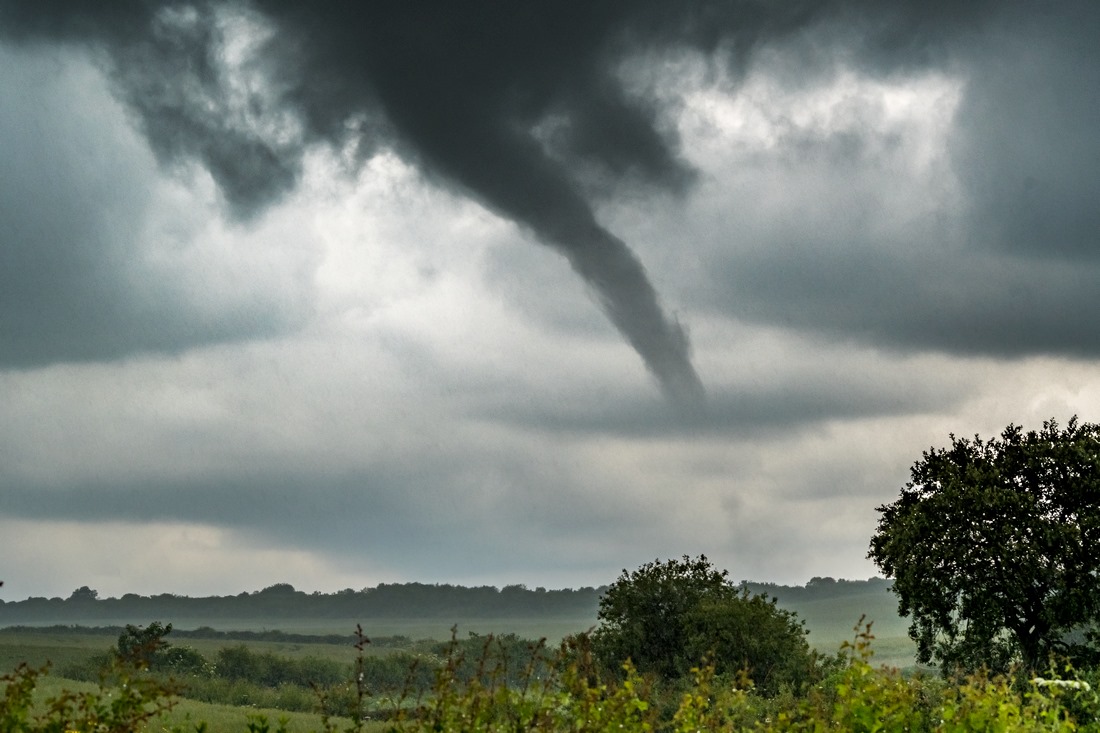

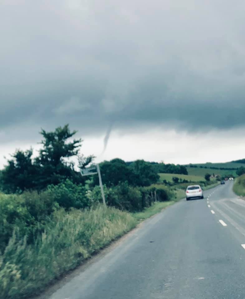
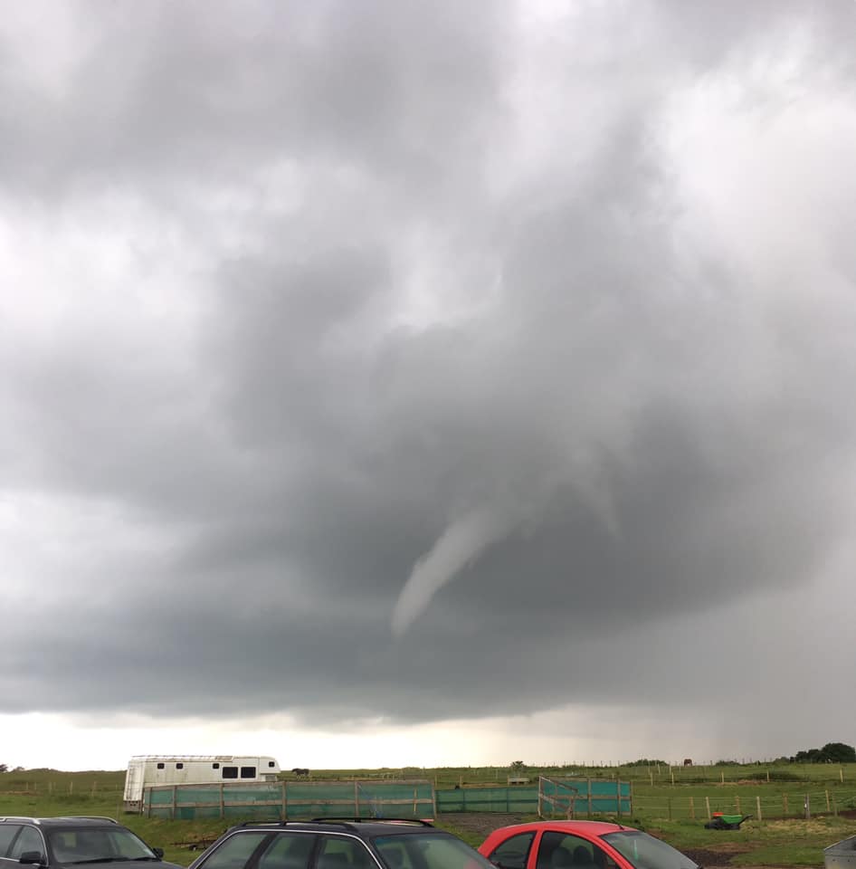
A tornado developed in the skies above the Isle of Wight this afternoon (Wednesday), local weather forecasters have confirmed.
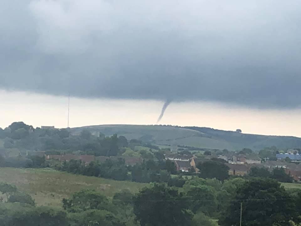
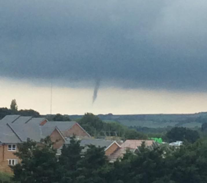
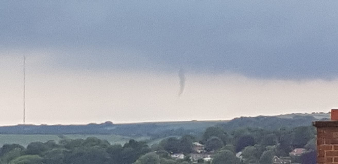
IW Met Service – the official weather partners of Island Echo – captured on camera a large funnel cloud that developed into a tornado as it touched down in the Bleak Down area of the Island.
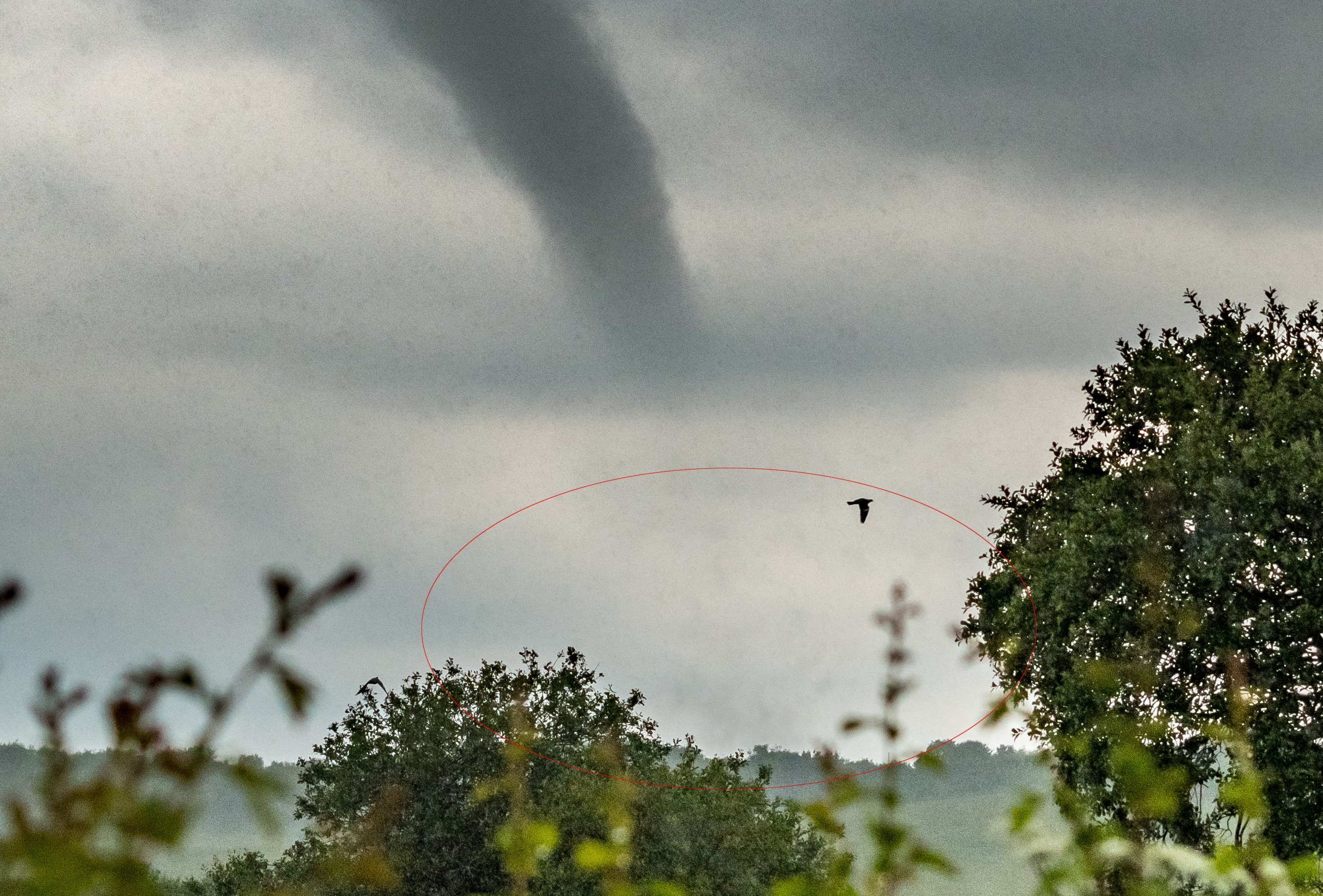
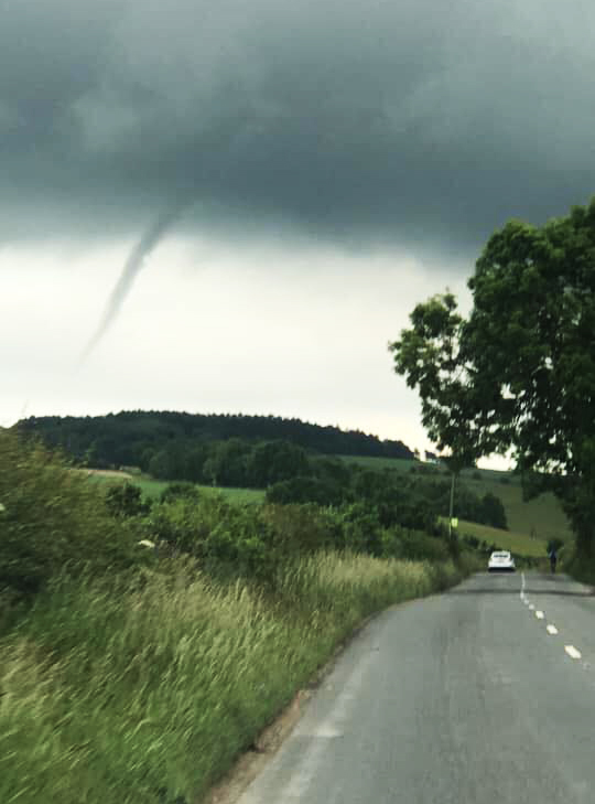
Tornados are not to be confused with funnel clouds, a number of which developed across the Island throughout the afternoon – as captured on camera by eagle-eyed Island Echo readers.


A tornado is a rapidly rotating column of air that is in contact with both the surface of the Earth and a cumulonimbus cloud or, in rare cases, the base of a cumulus cloud. According to IW Met Service’s Chief Forecaster and photographer, Jamie Russell, there is enough evidence to show that a tornado was formed with reports of rotation by a number of people on the ground.
For the latest weather forecast for the Isle of Wight, including a Festival forecast, visit www.iwmetservice.co.uk.


Fetch me my ruby slippers will you 😀
*Gives Tim C ruby slippers* now click them 3 times and say get me the hell out of here toto
Was Blake Down
can i just say the ads when clicking on news story’s is so annoying.