

























































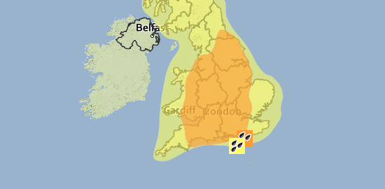

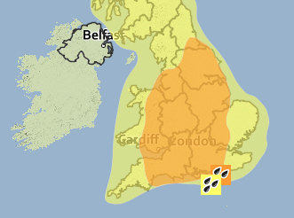
 UPDATED: An amber weather warning has been issued by the Met Office for heavy rain across the Isle of Wight tomorrow (Saturday).
Several areas of heavy, thundery showers will develop late tonight and will move northwards across the country throughout Saturday. Some torrential downpours are likely with frequent lightning, large hail and locally strong gusts, similar to that experienced last night.
Significant flooding is possible and readers should be prepared for the risk of disruption.


UPDATE @ 17:00 – The Isle of Wight Council have this afternoon advised residents living in the following areas to consider taking precautions against flooding.
- Monktonmead Brook, Ryde
- Gurnard Luck, Gurnard
- Western Yar, Freshwater
- Lukely Brook, Newport
It has been confirmed that sandbags are available at the following locations:
- Well Road, East Cowes
- Simeon Street Rec, Ryde
- St Mary’s car park, Cowes
- River Road, Yarmouth
- Moa Place, Freshwater
- Marsh Road, Gurnard
- Lugley Street, Newport
Monktonmead Pumping Station in Ryde is said to be operating correctly, with temporary pumps on site which can be used in an emergency. The Monktonmead outfall has also be cleared to increase drainage capacity. Environment Agency Staff will be available to man the pumping station over the high tide period which will be at 04:00 tomorrow morning.
Firefighters are set to strike between 23:00 tonight and 01:00 tomorrow morning. Contingency crews will be in place, however limited fire cover is available.
Stay connected with IslandEcho for the latest around the clock, keeping you up to date and moving across the Isle of Wight.