


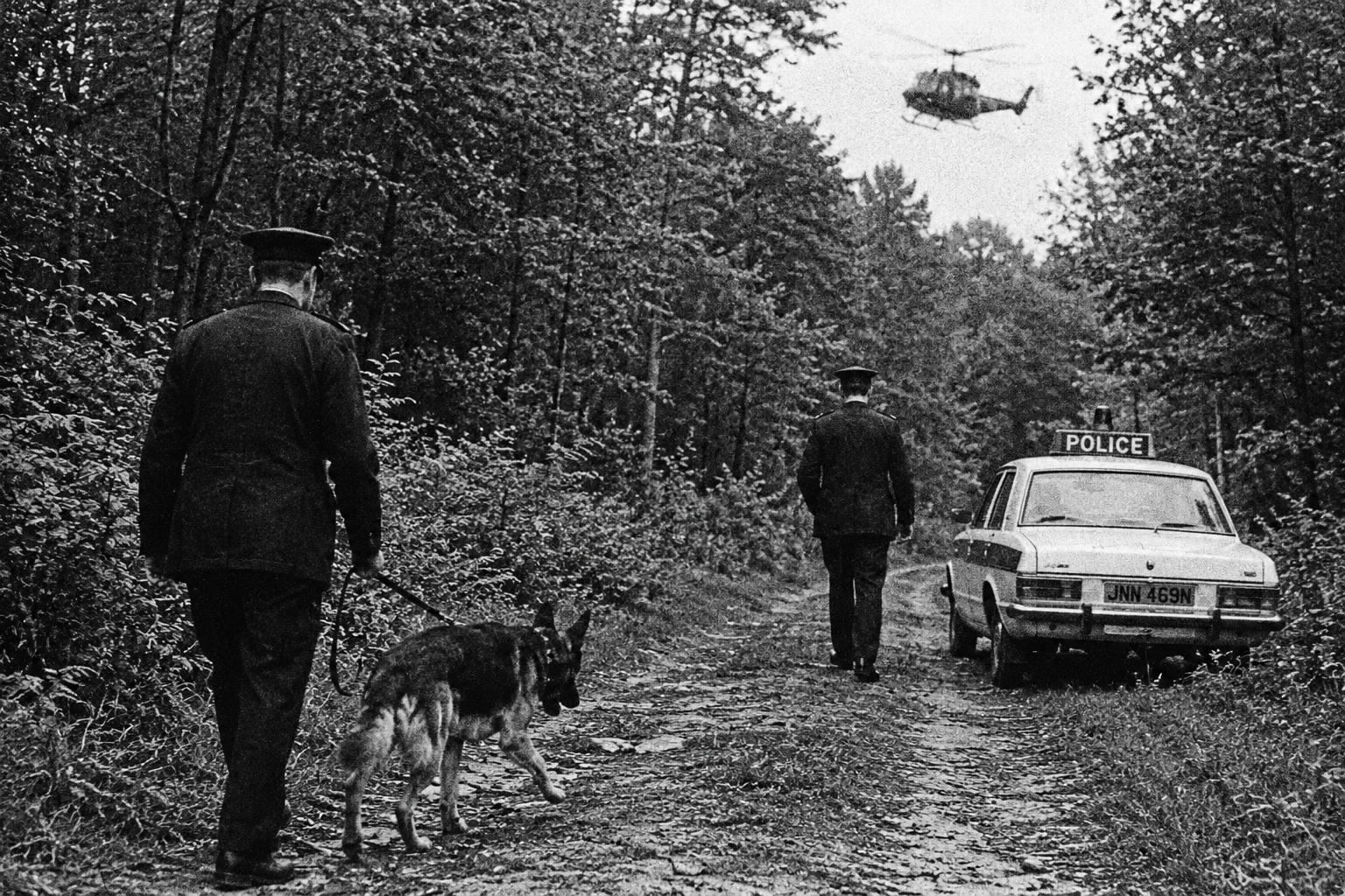


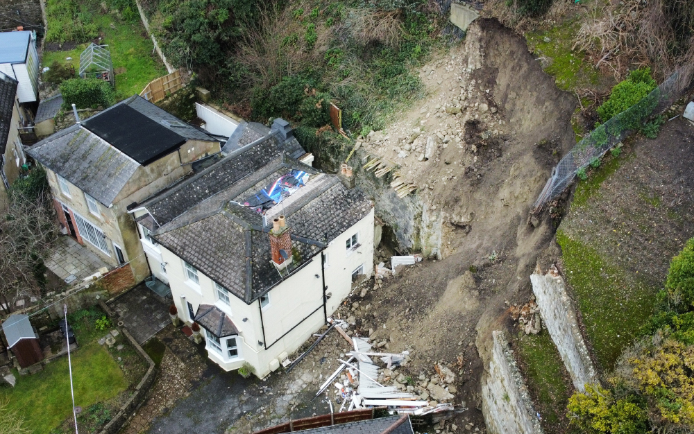

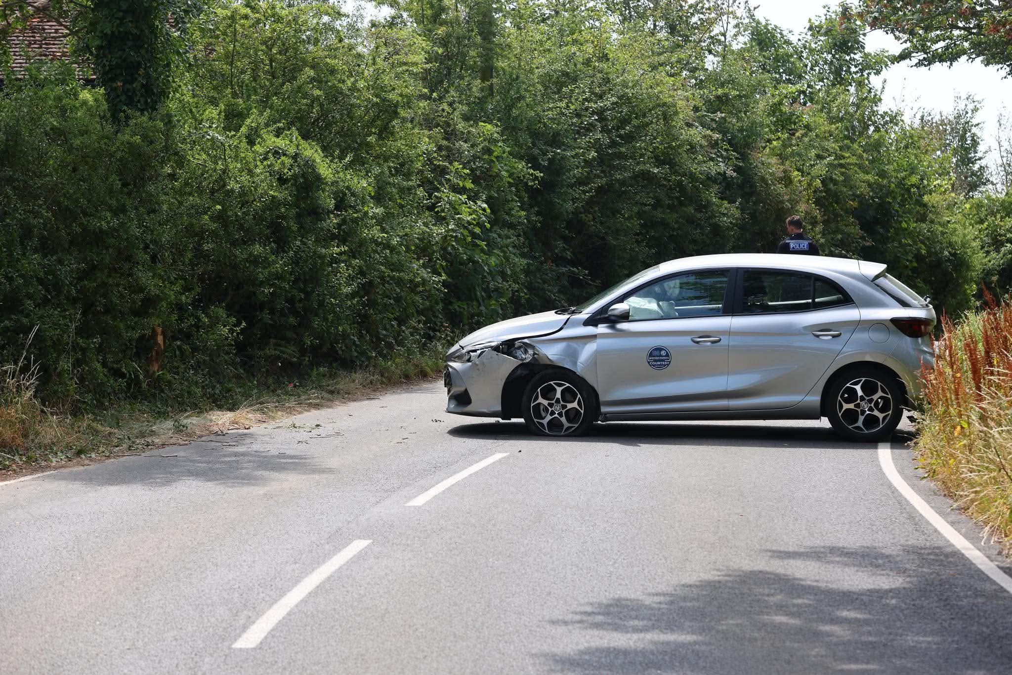
 Dramatic photos and video have revealed the full extent of yesterday’s landslide in Ventnor, which saw hundreds of tonnes of earth collapse into the rear of a residential property.
Emergency services were called to the scene at The Grove, off Alpine Road, at just before 15:30 yesterday afternoon (Saturday), as first reported by Island Echo.
Fire crews arrived to find an area measuring 30x20m collapsed and 2 people trapped inside their property. Firefighters from Ventnor, Shanklin, Ryde and Newport utilised ladders to evacuate a man and a woman to safety via a first floor window.


The situation arose when a large retaining wall gave way after more than 30mm of rainfall in just 12 hours.
Although no one was injured as a result of the landslide, a workshop garage was completely destroyed and there has been some damage to the main property also. Building inspectors have been out to conduct a survey of 2 flats and surrounding houses.
WATCH – Exclusive drone footage captured by Island Echo shows the extent of Ventnor landslide from above


Ventnor is a very risky area to buy property, always has been. I hope the occupants are well insured, it must have been very upsetting for them.
Rubbish! This could happen anywhere it’s a landslide due to excessive rain not land movement. Most of ventnor is fine that’s why we still have all the old properties. I’d rather live there than on the flood plains they keep insisting on building on like mortonbrook.
Ventnor has a history of ground stability problems, FACT!!!
And as I said this is not a ground stability issue. A retaining wall collapse due to rain/ maintenance etc . Read Andy’s comment further down! This property is on a stable very flat part of the town. It was the wall behind that collapsed.
http://www.coastalwight.gov.uk/PDFs/TheUndercliffoftheIsleWight.pdf
I’m not denying there’s geographical issues in the area just that this one was a retaining wall collapse on a flat part of the town. Who knows why. it could’ve been built badly or the excessive rain contributed to the collapse but that’s neither here nor there as walls can be rebuilt and houses repaired at least people weren’t hurt. You certainly went to a lot of trouble to try and prove a point. You need to get out more!! Well maybe not just at the moment!
I agree, it’s called VENTnor because there are VENTS all over the place, it’s always been an unstable and risky area to buy property. Yes situations like this could happen anywhere but Ventnor is more likely to have land slips and sinkholes etc. Anyway, I hope everyone is alright and not too shaken up
If it’s that risky how come houses prices are stable and loads of second homes purchased and insurance isn’t anymore expensive than anywhere else? That’s a view from years ago that’s now changed. Remember a good majority of houses in ventnor are 200+ years old and still standing. I seem to remember reading about a sinkhole in appley?!
Not true that insurance isn’t more expensive than anywhere else. For a start it’s almost impossible to find a company that will insure a property within postcode PO38. When you do get insurance there’s a huge excess for land movement and the premium is way above what you would pay elsewhere.
Not true at all. Where do you get your information? That may have been the case years ago but it’s changed now I should know I’ve lived in ventnor and owned property here for over 25 years and never had an issue with insurance and certainly not had any huge excess for movement and pay just over £140 a year! And I can easily get loads of companies to insure me if you go on any comparison site. Po38 is not just ventnor either.
What is the Ventnor Undercliff Landslide Complex?
The Undercliff is a landslide complex in Cretaceous soft rocks, a bench of slipped clays and sands above a low sea-cliff, backed by higher (100 metres (330 ft)) Upper Greensand and Chalk cliffs.
The largest urban landslide complex in northern Europe, it dates from two main phases of landslides after the last Ice age: 8000–4500 years and 2500–1800 years ago. It is flanked by highly active landslip zones that have seen major slides over the past two centuries: Between the Blackgang landslip at the west, and the Bonchurch Landslips in the east..
Is this landslip in line with last years and also possibly due to the removal of all the trees and undergrowth just off Newport road where the ‘new’ builds are?
Those giving permission ought to know better.
Wow, you really shoehorned in your own agenda in there didn’t you with no consideration for the people involved in this and how they feel. Have some respect.
Can someone explain to me how the people were “trapped”? It looks like there is a door at the front of the property, or at least a window. Why did they have to be rescued from the first floor, is it a pair of flats perhaps? Just curious really, thanks
Could have been much worse.
It is NOT A LANDSLIDE, a retaining wall has collapsed from age.
Well said
About ten thousand years ago, sea levels began to rise and the great ice sheets of the last Ice Age melted. As sea level rose, the estuary of the Solent River was gradually inundated until eventually the Isle of Wight became separated from the mainland. This is thought to have occurred about 7,000 years ago, and load of overners got stuck on the this new Island that was formed.