


 The IW Met Service has issued a yellow weather warning for strong winds and large waves, which is set to come into force on Tuesday (6th July).
A small but unseasonably strong low pressure system will move in from the southwest during the early hours of Tuesday morning, bringing with it spells of heavy rain, strong/gale force winds and some very large waves.
The service says that wind gusts of 50-55mph are possible in more exposed parts of the west and south during daylight hours, peaking some time during the morning, but slowly easing after midday.


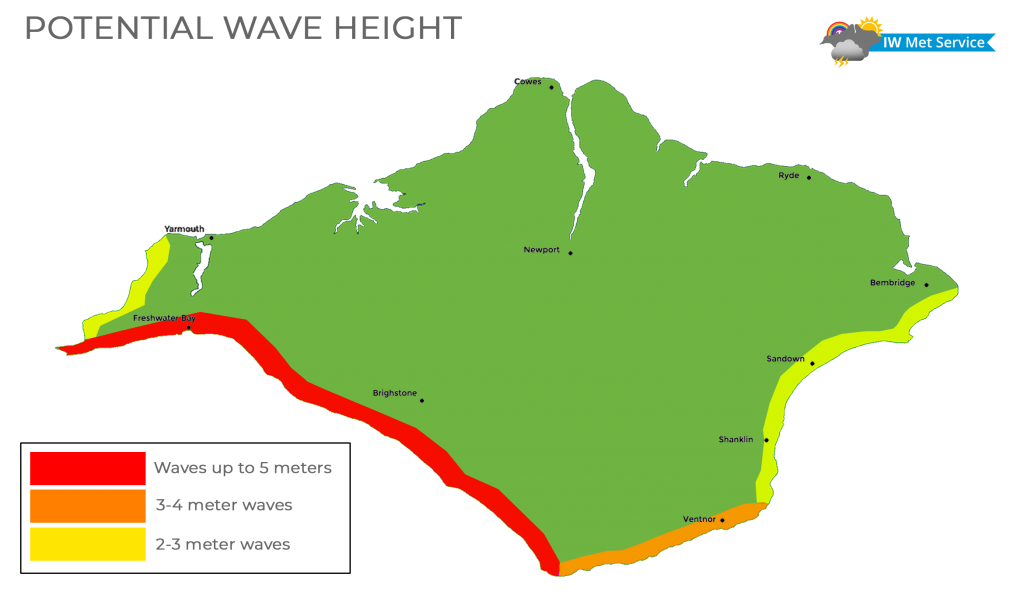
Wave heights of up to 5 meters are expected along western coasts.
Chief Forecaster, Jamie Russel, says that Islanders should expect the possibility of falling tree debris with leaves, twigs and possibly small branches in places.
Jamie says:
“Very large and dangerous waves could be experienced on exposed beaches affecting small watercraft, with sudden and unexpected waves and surges washing up beaches with significant risk of being swept off your feet or washed out to sea, especially along the west coast of the Island.
Article continues below this advertisement “However we are not expecting any flooding and only very minor over-topping due to the small tides.”

The warning will be in force between 02:00 and 16:00 on Tuesday (6th July).