


A major river restoration project along the Eastern Yar has been hailed a success after delivering significant benefits for wildlife, flood resilience and local communities.
Hampshire and Isle of Wight Wildlife Trust is celebrating the completion of its ambitious Eastern Yar River Restoration Project, a two-year scheme designed to reconnect the river with its natural floodplain and restore rare wetland habitats.
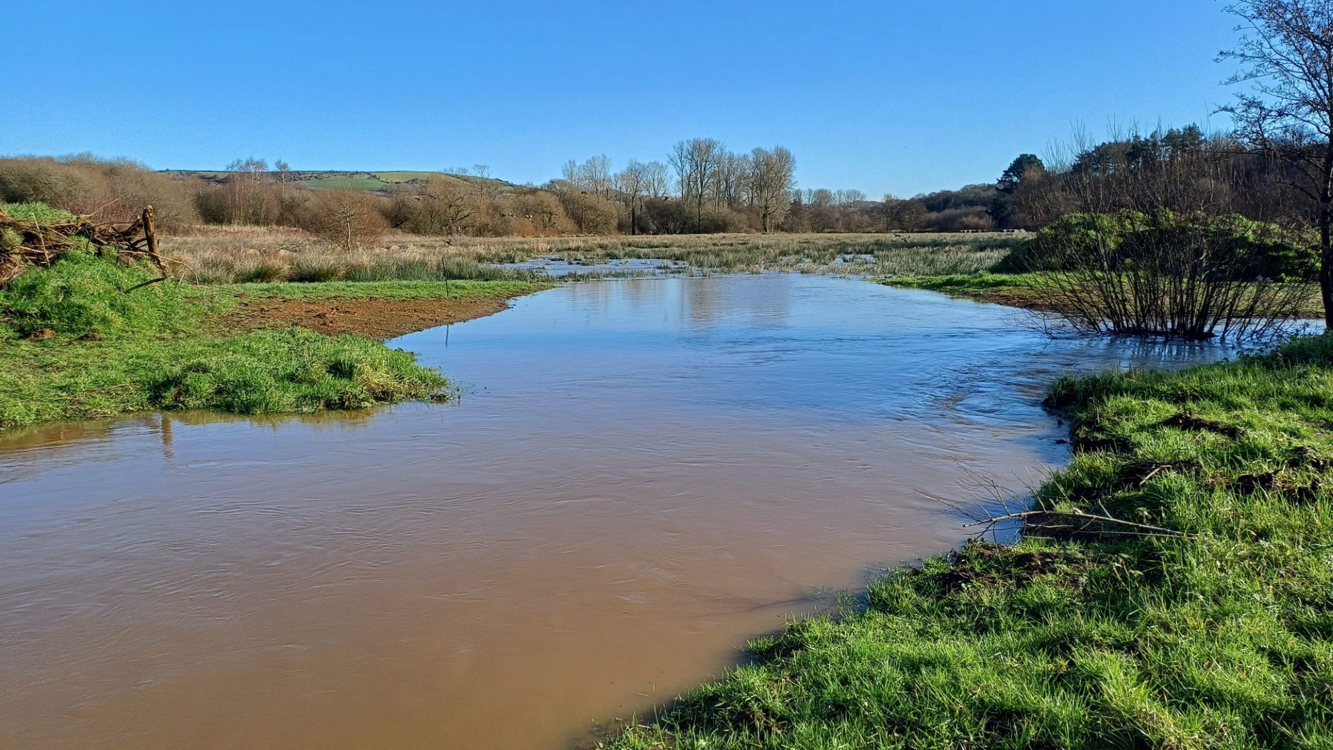
The project focuses on land stretching from Newchurch to Sandown, including Newchurch Moors, Alverstone Mead, Sandown Meadows and Morton Marsh nature reserves. Historically, this area functioned as a natural floodplain, but decades of dredging and river modification had disconnected the river from the surrounding valley, increasing the risk of flash flooding during periods of heavy rainfall.


Wetlands are among the UK’s most threatened habitats, with more than 90% lost over the last century. Floodplains act as natural sponges, absorbing and holding water during wet periods, slowing river flows and reducing flood risk downstream, while also providing vital habitat for amphibians, invertebrates, wading birds and specialist wetland plants.
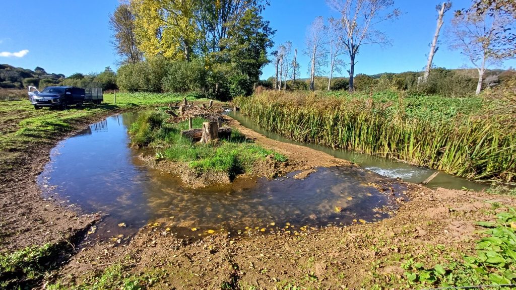
As part of the restoration work, sections of the riverbank have been re-profiled and features such as swales and grips created, allowing water to spread and settle naturally across the valley once more. Work at Morton Marsh and Lower Knighton included the management of dangerous trees, creation of standing dead wood, removal of declining willow and encroaching scrub, re-profiling of river channels and surrounding land, and upgrades to water-level control infrastructure.
One of the project’s most significant achievements is the increase in natural flood storage. By removing historic raised riverbanks and installing small protective bunds, the floodplain can now hold an estimated 155 million litres of water – the equivalent of around 62 Olympic-sized swimming pools.
Jamie Marsh, Director of Land Management at Hampshire & Isle of Wight Wildlife Trust, said:
“When you walk the floodplain now, you can feel water moving where it hasn’t been able to for decades.
“Restoring the river’s natural function, which will reduce the intensity of downstream flooding, has taken a huge amount of care, planning and teamwork. I’m deeply proud of the result and that we are creating a thriving wetland habitat, whilst building a more climate-resilient Eastern Yar valley.
“What excites me most is that this is only the beginning. The valley will continue to change, settle and flourish over the coming months and years, and I can’t wait to watch wildlife return to a landscape that is fully functioning just as it should.”
Early signs of recovery are already being seen, with water spreading naturally across previously disconnected areas during rainfall, wetlands re-wetting and fen plants beginning to recolonise land that had previously dried out or become heavily shaded.
The restored habitats are expected to benefit a wide range of species across the valley, including snipe, lapwing, teal, little egret and kingfisher, alongside dragonflies, damselflies, amphibians and pollinating insects. Wetland plants such as marsh cinquefoil, yellow flag iris, hemp agrimony and fen bedstraw are also expected to return in greater numbers.
The project was delivered in partnership with Wessex Rivers Trust, Isle of Wight Council and the Environment Agency, with funding provided through Natural England’s Countryside Stewardship Capital scheme, demonstrating what can be achieved when organisations work together to restore landscapes for both wildlife and people.


The big question, of course, is will this make the increasingly frequent flooding of the main road between Sandown and Brading better or worse?
Well so far it hasn’t flooded this winter after heavy rain, not enough to shut it anyway.
Not so far it has not it was flooded again very recently
Better, obviously, because the water has it’s floodplain restored and away from the only other ‘drain’…the road, which had previously become the lowest point.
To be fair, I don’t think it’s flooded to a road closure point this winter, yet.