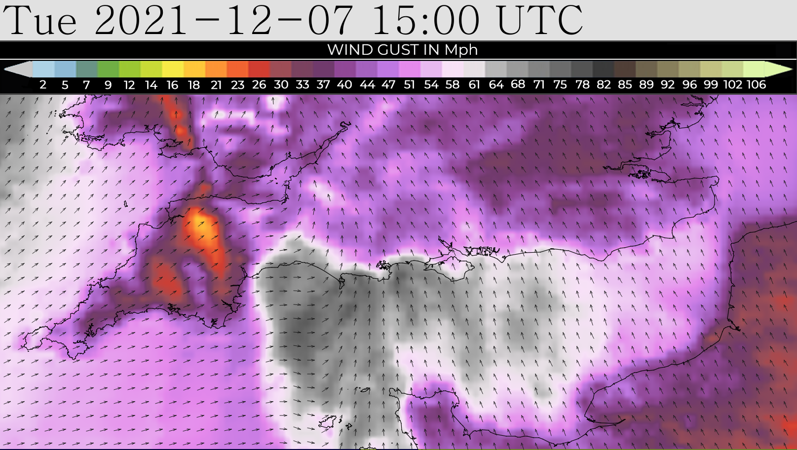


 A second weather warning has been issued for the Isle of Wight, with both severe gales and heavy rain now set to batter to the Island tomorrow (Tuesday).
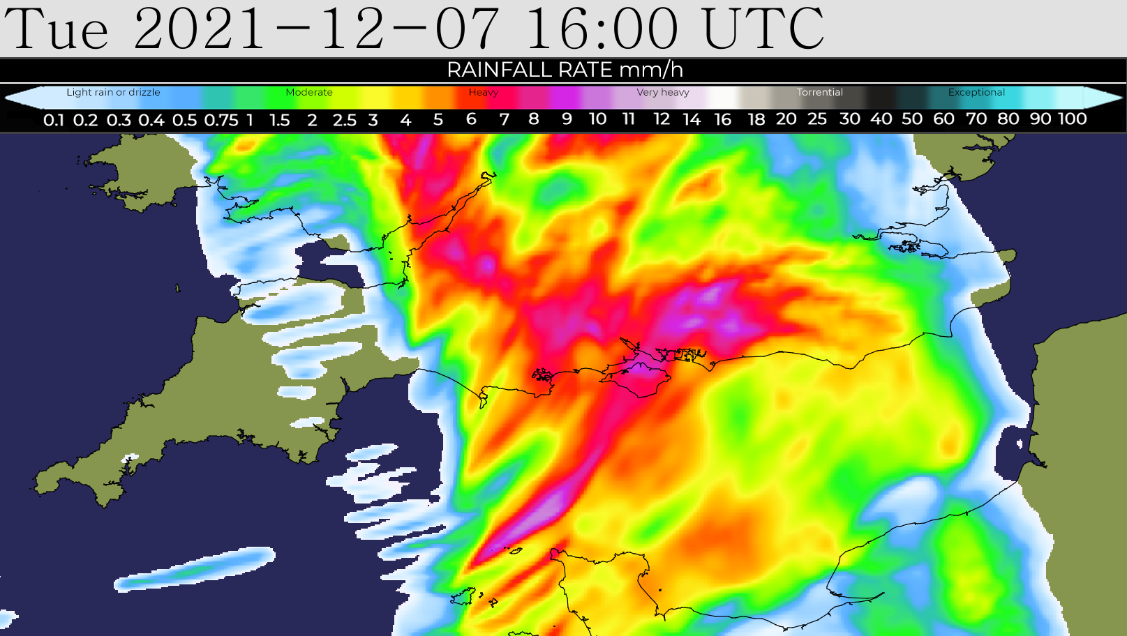
As previously reported by Island Echo, IW Met Service forecasters issued a yellow weather warning for strong winds yesterday afternoon. Now, the forecast shows that rain will play a part in tomorrow’s adverse weather resulting in a separate warning published.
Forecasters say that a small but potent area of low pressure will move in from the west, bringing with it a spell of very strong southerly winds. Gusts of 50-60mph are expected widely with 70-75mph gusts over hills and on windward coasts for a short time.


Accompanying the wind will be a spell of very heavy rain, possibly torrential at times with the risk of hail mixed in.
Localised flash flooding in the usual prone areas could occur.
Falling tree debris such as leaves, twigs and branches, with perhaps even the odd downed tree in some places, will create a hazard on the roads with treacherous driving conditions expected for a time. Silt, sand and other field run-off debris, especially in more rural parts, will create an additional hazard.
Overtopping waves around the Island’s western, southern and eastern coasts, with some minor breaching of sea defences along the Solent coasts, is expected. There is also a risk of pollution on the Island’s beaches from storm overflows.
Islanders should expect travel delays including to cross-Solent services.

Both warnings are in force from 10:00 until 18:00 tomorrow (Tuesday 7th December).