















































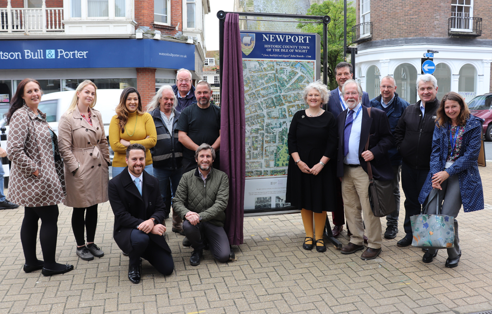

Newport and Carisbrooke Parish Council have unveiled a new town map in order to help visitors and local people discover and find their way around Newport.
The map, jointly funded by NCPC and a £3,000 grant from IW Chamber of Commerce, was manufactured by Newport-based company AJ Wells from a hand-drawn map by Alan Rowe of Carisbrooke.
Situated opposite the Guildhall in the High Street, the map features a timeline of Newport’s history, for instance, The Treaty of Newport between Charles 1st and Parliament 1648 and the Luftwaffe air raid of 1943. Going forward the map will incorporate a local directory highlighting local businesses, encouraging people to seek them out.


Councillor Julie Jones-Evans, Chair of Newport and Carisbrooke Parish Council said:
“I’m overjoyed at how this map has turned out. It’s a wonderful interpretation of a part of The County Town which is not only a beautiful legacy, but a practical guide that will assist in wayfinding, which Shaping Newport highlighted as an issue.
“Alan Rowe and AJ Wells have produced a stunning piece of public art and we are proud to have a prominent example of world class enameling in the town it is made.”
The map will tie in with the Newport Living History project which is gathering information about Newport in the last 100 years through face-to-face interviews and photographs.
Canvas copies of the map are available for sale from 30 High Street and NCPC.





Another waste of tax payers money…in a world of free internet and mobile phone maps..thanks council yet again loads of people and money and time wasted..oh well just ad it on to the bill for st marys scheme..why couldn’t you spend the 9 million on a bridge from dodnor to seaclose instead…idiots!!!!