



























































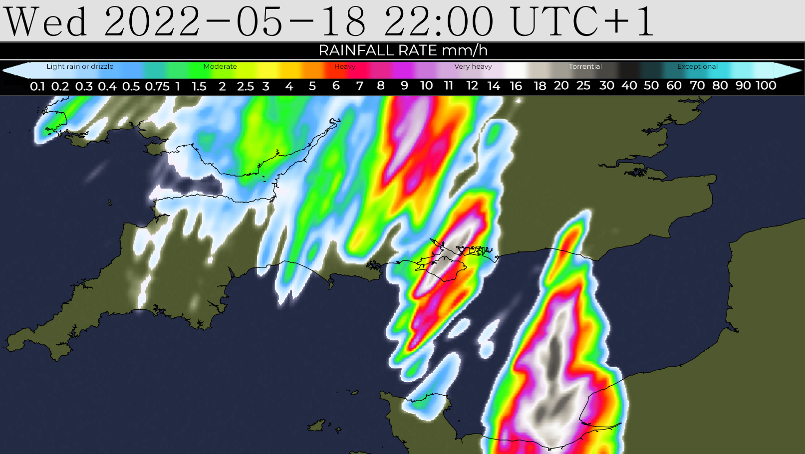
 Heavy thundery downpours are expected across the Isle of Wight tonight (Wednesday), which has led forecasters at IW Met Service to issue a yellow weather warning.
An area of heavy showers and thunderstorms will develop towards the South and South West of the island through this evening, and these will move North Eastwards towards the South and South East coast of the UK.
The Western extent of these showers and thunderstorms is highly uncertain, but current model projections are showing a moderate risk of them being far west enough to impact the Island for a time later this evening.


Locations that are affected by these showers and storms will see some very strong wind gusts of up to 60mph, lightning which may be frequent, torrential rain and possibly hail. However, these conditions will be very localised. The risk of anyone place receiving a direct hit is rather questionable.
The warning is in force from 19:00 this evening until 01:00 tomorrow morning.
You can follow the storm’s movements at https://www.iwmetservice.co.uk/rain-radar-2/.
Islanders should be aware of the risk of torrential rain leading to localised flash flooding in places along with silt and soil being washed across roads and walkways in more rural parts. There is also a risk of falling tree debris, perhaps even the odd downed tree where the most severe gusts and rainfall combine.









all it was was lightning wheres the thunder
I thought that as well. The lightening was close enough for it for it to have been very loud so why was it silent.
Nature x Was on hols in West Sussex – MAJOR thunder and lightning. Quite spectacular x