


 The Isle of Wight can expect to see heavy rain showers with a risk of hail and thunder tomorrow (Tuesday).
A yellow weather warning has been issued by the IW Met Service and is valid from 07:00 until 21:00 on 1st October.
As well as a risk of hail and thunder, forecasters say there is the potential for shower trains to develop – where one shower after another follows the same path. The showers will be localised but this means that some places may see large rainfall totals, with other areas of the Island seeing negligible amounts.


Up to 30mm of rain could fall in some places with other areas seeing less than 5mm.
IW Met Service has also issued an advisory for minor flooding overnight.
Elevated sea levels will be witnessed once again, bringing the risk of some minor flooding in roads adjacent to the sea. Yarmouth, Cowes, East Cowes and Newport are the main areas at risk.
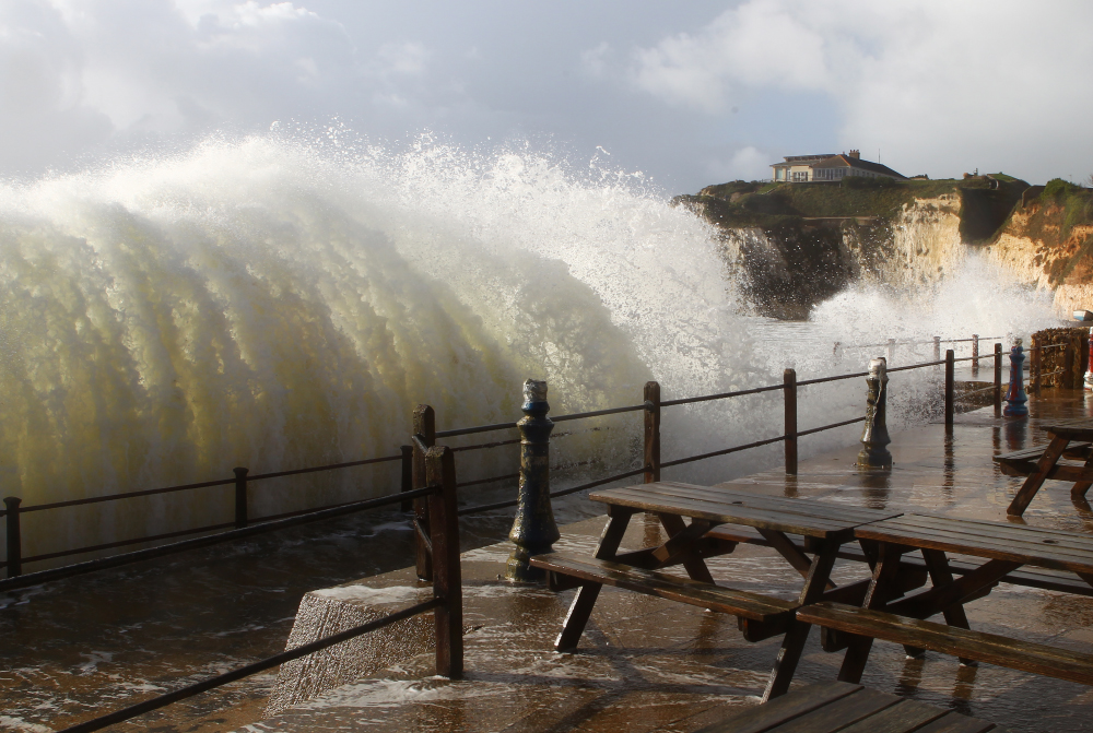
Large waves along the coastline will also cause some minor breaching/over-topping of sea defences. The risk of large over-topping waves will be at Freshwater Bay, Ventnor, Bonchurch, Shanklin and Sandown. These areas will see mostly just large amounts of spray, sand and shingle thrown onto walkways.
For more on the Island’s weather visit www.iwmetservice.co.uk.


all aboard the shower train!!
The shower train…. That’s a new one.
Probably do it when I’m picking up my granddaughter from school! She’s 7 and she hates thunder!
I know we’re getting new trains……but trains with showers?