




























































 Another weather warning has been issued for the Isle of Wight as heavy rain is expected throughout tomorrow (Saturday), bringing a further 45mm of rainfall and a real risk of flooding. Local forecasters IW Met Service say that a large area of heavy rain will move across the Island throughout tomorrow morning, leading to around 15-20mm of rainfall in many places. Once the rain clears through there will be further heavy showers, sometimes merging into longer spells of rain. This will bring a further 20-25mm of rainfall locally, although the majority of places should see between 5-10mm. This next bout of adverse weather could bring rainfall totals of between 40-45mm in places. Jamie Russell, Chief Forecaster at IW Met Service, says:
“The ground is completely saturated across the majority of the Island, so just 10-15mm of rainfall has the potential to cause flooding”.
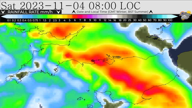 Islanders should be aware of localised flash flooding during the heaviest downpours, as well as further flooding of low lying land. There is a risk of rivers breaching their banks. The yellow weather warning is in force from 02:00 on Saturday 4th November until 02:00 on Sunday 5th November.