






























































A yellow weather warning has been issued for the Isle of Wight, with forecasters predicting heavy rain and the risk of damaging winds tonight (Wednesday) into Thursday morning.
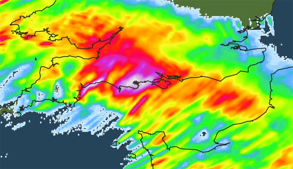
IW Met Service has issued the alert advising that a small but powerful low pressure system is expected to pass close to Southern England from 19:00 tonight through to 11:00 on Thursday.
The exact path of the system remains uncertain, but forecasters say significant rainfall is the most likely threat. Up to 40mm of rain could fall in some areas, raising the risk of localised flooding.


However, if the weather system tracks slightly further north, strong winds could also become a factor. Gusts of up to 80mph are possible in exposed coastal and hilly areas, although this scenario currently has only a 20% likelihood, according to Cheif Forecaster Jamie Russell.
Islanders should expect flooding in areas prone to high rainfall, with surface water and spray creating hazardous driving conditions.
Debris such as stones, dirt and shingle could be washed across the roads, with falling leaves, branches and other tree debris an additional risk.
Cross-Solent services could face delays or cancellations.










wasn’t that bad..was just normal rain..
And I waited up all night for the excitement of some bad weather ,mmm what the F happened not the first or the 10th time they got it wrong again and again and again