

































































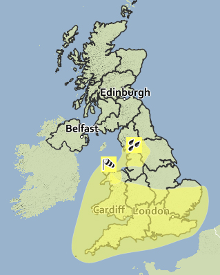
 UPDATED: The Met Office have issued a yellow weather warning for severe gales tomorrow (Tuesday) as Storm Barney approaches, which could lead to cross-Solent and Island-wide disruption.
Gusts are expected to reach 60-70 mph inland and possibly 80 mph along exposed coasts such as the Isle of Wight. Islanders are being warned that gusts of this strength could bring down trees and lead to some damage to weakened structures.
In addition, cross-Solent services are expected to be disrupted.


The weather warning is in place from 15:00 until 23:30, with the worst of the adverse weather expected to reach the Solent area in the evening.
UPDATE TUESDAY: The Met Office have pushed back today’s weather warning from 15:00 until 16:00, although the bad weather is expected to start moving in locally from 11:00.
UPDATE TUESDAY @ 09:52 – The Met Office have amended their warning, listing minor impact instead of moderate impact, however the likelihood of the strong winds has increased. Gusts are now expecting to be between 50-70mph and will continue until the early hours of Wednesday morning.
Stay connected with Island Echo for all the latest news and travel information – Join us on Twitter at www.twitter.com/islandecho